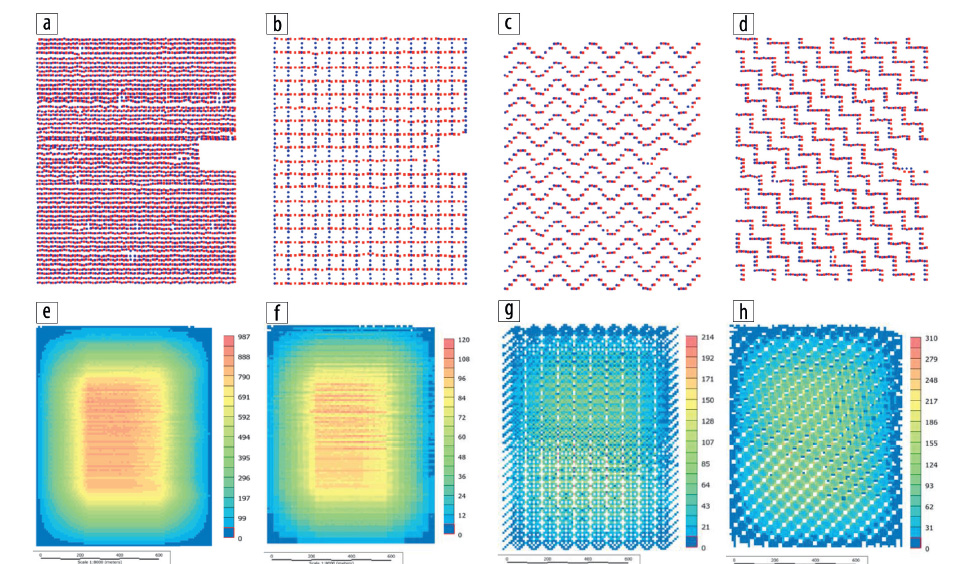
All exploration and production projects, whether for oil-and-gas, mining, or clean-technology applications, begin with an accurate image of the subsurface. Many technologies have been developed to enable the acquisition of cost-effective seismic data, with high-density land seismic programs becoming commonplace. However, as the industry progresses and the long-term surface footprint associated with these programs becomes better understood, new methods are needed to reduce the environmental impact of seismic data acquisition while maintaining sufficient subsurface resolution for accurate resource development. New acquisition geometries are typically easier to create than test in the field due to the high cost of field acquisition and processing. However, by using existing data acquired in a grid, one can decimate the original data set into multiple geometries and process them. This provides an opportunity to fully test new geometries without the expense of field acquisition. In this paper, we present processing, interpretation, and inversion tests from an existing ultra-high-density oil-sands seismic data set decimated based on ecologically improved program designs. We then measure and compare the results to understand the impact of these geometries on subsurface resolution.

PUBLICATION DATA
© 2023 by The Society of Exploration Geophysicists
Publisher:Society of Exploration Geophysicists
History
Published Online: 03 Jan 2023
Published in print: 01 Jan 2023
CITATION INFORMATION
Mostafa Naghizadeh, Peter Vermeulen, Andrea Crook, Alyson Birce, Stephanie Ross, Aaron Stanton, Maximo Rodriguez, and Warren Cookson, (2023), “EcoSeis™: A novel acquisition method for optimizing seismic resolution while minimizing environmental footprint,” The Leading Edge 42: 61–68.
https://doi.org/10.1190/tle42010061.1