By Andrea Crook, P.Geoph.
Summary
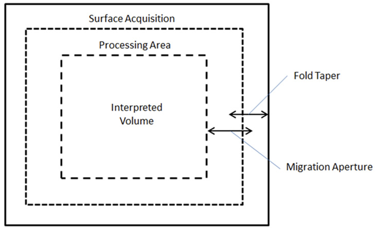
When planning a seismic survey, the total cost of the survey is dependent on the surface area. However, the optimal surface area may be significantly larger than the subsurface imaging area. This is due to the need for a survey taper which must be added to the subsurface area in order to properly image subsurface targets. Depending on the target depth, the addition of the survey taper may increase the surface area by as much as 50 to 100% relative to the subsurface area.
Factors affecting the size of the survey taper include, in order of importance: target dip, target depth, and survey geometry (specifically, the recording patch size). These factors are used to calculate various survey taper distances based on dipping events, diffraction aperture, migration aperture required in processing, and fold taper. In addition to these considerations, if a survey will be merged or if quantitative interpretation will be applied, then the surface survey area may need to be adjusted further in order to provide enough overlap in the subsurface or long enough far offsets for attribute analysis.

Figure 1: Relationship between subsurface imaging area and surface acquisition area.
